
When Iceye co-founders Rafal Modrzewski and Pekka Laurila began looking for promising markets for synthetic aperture radar (SAR) data, they focused exclusively on the Arctic.
It was a natural fit for the Finland-based SAR constellation operator founded in 2014. Eight years later, the Arctic remains a key market for Iceye due in part to its lack of terrestrial infrastructure.
“The only way to monitor it is through satellites,” Modrzewski said.
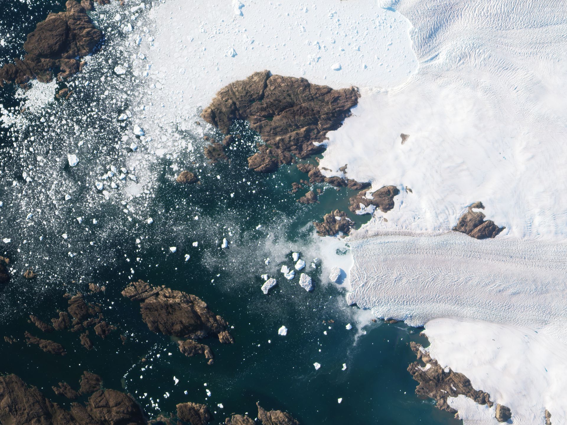
As Arctic sea ice dips to new lows, economic activity in the region is picking up. Meanwhile, soil under the Arctic tundra is thawing while some vegetation above is flourishing. To track the changes, companies and academic researchers often turn to satellite-based data products.
Spire Global, for example, is developing datasets to help people make decisions about what to do as the Arctic region evolves over time, said Kevin Petty, Spire vice president of weather and Earth intelligence.
With a fleet of more than 110 satellites, Spire tracks the movement of ships and airplanes through the region in addition to gathering atmospheric temperature, pressure and moisture data by noting how signals from GPS and other Global Navigation Satellite Systems change as they pass through the atmosphere.
By observing how the same signals reflect off Earth’s surface, Spire also can provide customers with data on soil moisture levels and sea ice.
Planet is shedding light on the Arctic with more than 200 satellites in polar orbit acquiring electro-optical imagery.
German researchers developed a deep learning model for PlanetScope, Planet’s daily global Earth imagery, to identify areas where the Arctic permafrost is thawing and releasing methane, a potent greenhouse gas. The research, led by Germany’s Alfred Wegener Institute Helmholtz Centre for Polar and Marine Research and the University of Potsdam Institute of Geosciences, maps small landslides that occur when permafrost thaws rapidly.
“This is a type of application that we’re starting to see pick up quite a bit because we have so much coverage both spatially and temporally across the Arctic,” said Tanya Harrison, Planet scientific strategy director.
For instance, Sarah Cooley, a University of Oregon assistant professor, applies machine learning to Planet imagery to track changes in hundreds of thousands of Arctic lakes in areas where the permafrost stores carbon.
“Her results are suggesting that the combined action of all of these small lakes is actually going to be quite a substantial greenhouse gas source moving forward,” Harrison said. “That research is only possible with a dataset like this, because she’s looking at subseasonal scale over a massive area of the Arctic.”
Read more: Eyes on the Arctic: Satellites reveal changing conditions at northern latitudes by Debra Werner